RTA Interagency Signage Map Information Design, Chicago Region
The RTA’s Interagency signage program began in 2012 with a pilot program to use signage as a means for addressing the historic fragmentation of transit operations in the Chicago region, which includes buses and trains operated by three different agencies – CTA, Metra, and Pace, private operators such as the railroads, and station properties that are owned by dozens of different government agencies or private entities.
But these delineations don’t mater to a rider who just wants to know how to get from Point A to Point B. The purpose is to make it easy for people to travel throughout the region using transit. It should be as convenient as possible for riders to get where they need to go. This sentiment was confirmed by a survey of riders who were asked to prioritize several improvements for the region’s transit system. Riders prioritized having better connections and a seamless travel experience between CTA, Metra, and Pace.
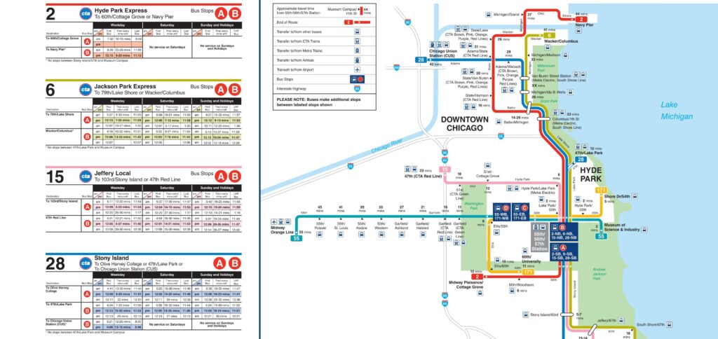
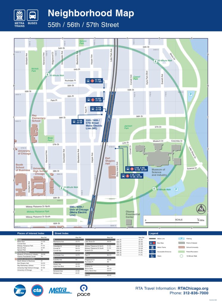
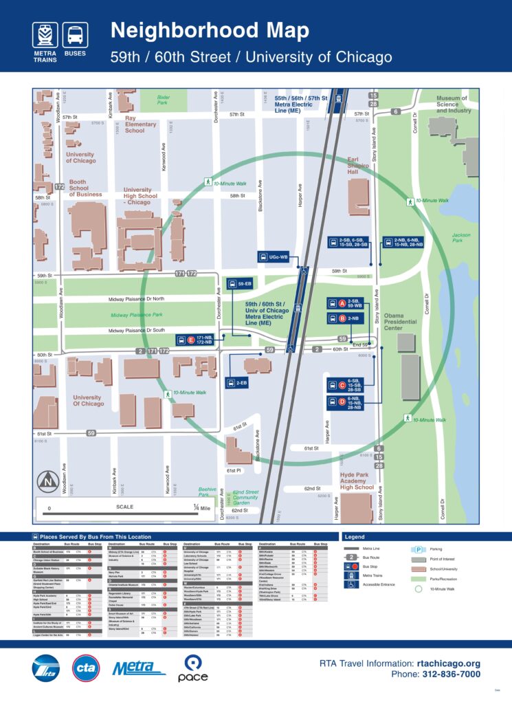
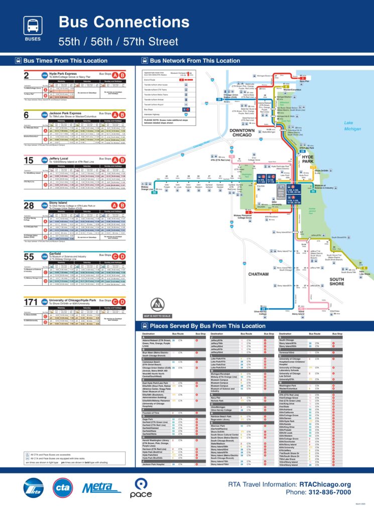
Sign fabrication and installation have been completed at several Metra stations. The signs, which include wayfinding, system maps, route diagrams, and schedules, have been installed at several major transfer points in the region where CTA, Metra, and Pace services intersect.
All images copyright and courtesy Epstein, Chicago, IL